
 James
Cook had returned from his first great voyage, on Endeavour, 1768–1771,
having charted the coasts of New Zealand and proven them not part of any great
southern continent.
James
Cook had returned from his first great voyage, on Endeavour, 1768–1771,
having charted the coasts of New Zealand and proven them not part of any great
southern continent.
Although this was a major contribution, there was still work to be done if the truth of the belief in a great southern continent to balance the northern landmass were to be finally determined one way or the other.
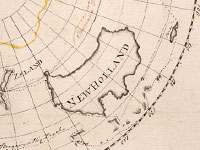
This map, drawn by Cook himself, shows his proposed route for a second expedition marked in yellow.
This was approved. The expedition set sail from Plymouth on 13 July 1772 and
dropped anchor back home on 30 July 1775. Throughout those three years, during
which Cook sailed further south than any man had done before, he crisscrossed
the Pacific and proved beyond doubt that there was no southern continent. The
idea that had perplexed Europeans for centuries was finally laid to rest by the
labourer’s son from Yorkshire.
Display item Map of the Southern Hemi-sphere, c.1771
< Previous Exhibit | Back to The Exhibits page | Next Exhibit >