
 Abraham
Ortelius published the first modern atlas, Theatrum orbis terrarum, in
1570. For the first time, a collection of maps of similar design and scale were
bound together with related text into one volume. The name ‘atlas’ derived from
Atlas, the kneeling Titan in Greek mythology who held up the world on his
shoulders. He had been condemned to do this as punishment for taking part in the
revolt of the Titans against the Olympian gods.
Abraham
Ortelius published the first modern atlas, Theatrum orbis terrarum, in
1570. For the first time, a collection of maps of similar design and scale were
bound together with related text into one volume. The name ‘atlas’ derived from
Atlas, the kneeling Titan in Greek mythology who held up the world on his
shoulders. He had been condemned to do this as punishment for taking part in the
revolt of the Titans against the Olympian gods.
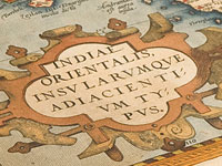
This 1575 edition is open at a map depicting South East Asia from India across to
north-western America. A particular feature of the period was the extravagant
decorations. In this map, two mermaids tend to their appearance with looking
glasses, while a caravel, a Portuguese sailing ship, battles an attack from two
sea monsters. The Coat -of-Arms of Portugal appears in the top left-hand corner
above a decorative cartouche containing the title of the map.
Display item Theatrum orbis terrarium, 1575
< Previous Exhibit | Back to The Exhibits page | Next Exhibit >