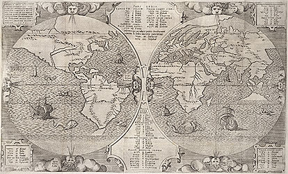
Mapping the world
Cartography or map making is a process which has developed over thousands of years. The evolution of maps in European history reflected the growing public interest in the geography of the world and the new discoveries made on ambitious voyages of exploration. Advances in mathematical sciences and navigation techiniques increased the accuracy of territorial surveys, permitting explorers to reach distant and mysterious places.
Benedict Arias Montanus sacrae geographiae tabulam ex antiquissimorum cultor [World map by Benito Arias Montano]. Published: Antwerp, 1572
Copper engraving MRB/ 933/ A (16th Century)
In the 16th and 17th centuries, world maps were an important tool for imperial European powers in developing lucrative trade routes and extending their political influence. The Spanish and Portuguese were very active in expanding their empires in the 16th century, followed closely by the Dutch who made important discoveries in the Pacific regions in the 17th century. In the 18th century France and England became powerful political rivals and empire builders.
> See a History Channel presentation on the early Mapping of Australia


