Cook's second voyage of discovery
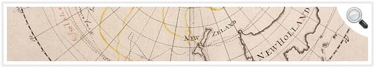
Cook's second Pacific voyage (1772-1775) aimed to establish whether there was an inhabited southern continent in what we now know as Antarctica. Two ships, Resolution and Adventure, were fitted out for the expedition. In 1772, before he set out, Cook created a map which showed the discoveries made in the Southern Ocean up until 1770 and sketched out his proposed route for the upcoming voyage.
> View Captain Cook's manuscript map from 1772
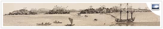
Cook's crew included naturalists, astronomers, and the expedition's official artist, William Hodges. While Hodges drew coastal views for navigation purposes, a large part of his work was to gather material for landscape paintings.
> View images from Cook’s second expedition produced by William Hodges and others
William Wales was the astronomer on board Resolution. Another astronomer, William Bayly, was posted to Adventure. Their work involved navigational measurements, particularly to do with longitude – a relatively new navigational calculation devised in 1761.
> Find out more about the work of astronomers, William Wales and William Bayly
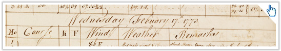
Cook’s second voyage of discovery departed Plymouth Sound on Monday 13 July 1772. In January 1773, Cook made his first crossing of the Antarctic circle, and allowed himself the claim of having been further south than any other person. The ships would not return to Plymouth until 29 July 1775.
> Learn more about Cook's method for preserving the health of his crew during the voyage