Charting the land
Sydney Cove lies 3 leagues to the northward of Botany Bay which is situated in Lat. 34 S : Long 151 E
The eastern coastline of Australia had been charted by James Cook during his first voyage of discovery in the Pacific in 1770 where he charted 5000 miles (8047 km) of the eastern coastline of the continent.
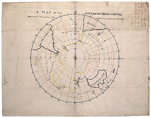
A map of the southern hemi-sphere shewing the discoveries made in the Southern Ocean up to 1770, by James Cook
Map ML Safe 1/82
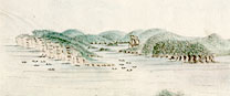
On the arrival of the First Fleet into Port Jackson, naval officers continued the hydrographic surveys of Sydney. Coastal profiles of the ‘Heads’ and surrounding coves were recorded, then exploratory parties travelled inland to present day Parramatta as well as north to Broken Bay and the Hawkesbury River, noting rivers, the terrain and quality of the land for cultivation.
British naval officers such as John Hunter, William Bradley and George Raper formed the earliest exploratory parties. All naval officers were trained in navigation, chart making and surveying, along with sketching. Young midshipmen learnt these skills at sea, taught by their seniors.
A number of the maps were included in published accounts of the settlement of the colony, such as Watkin Tench’s A Complete account of the settlement at Port Jackson and David Collins in his publication, An account of the English colony in New South Wales.
View the charts and maps:
Explore further the Library's online map collections: