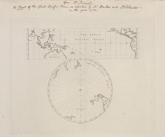
The Great Pacific Ocean, c. 1772
Printed map (2 maps on one sheet) London Purchased 2008 M2 910/1772/2
Printed map (2 maps on one sheet) London Purchased 2008 M2 910/1772/2
In the State Library’s manuscripts collection is an ‘Invoice received by
Banks from John Bayly, for paper and engraving plate of map titled 'The Great
Pacific Ocean', 26 March 1772’. The invoice was originally bound in a single
volume titled 'Voluntiers,
Instructions, Provision for 2d. Voyage' – papers concerning Banks' preparations
for James Cook’s second Pacific voyage in HM Ships Resolution and Adventure.
On
26th John Bayly wrote to Banks an account of his work engraving a map for him
of "The Great Pacific Ocean". Bayly, of Red Lion Square, London, was
engraver to the British Museum, of which Solander was Assistant Keeper. It is
thought that Banks intended plotting his route on this map as he voyaged in the
Resolution. He
presented a number of copies to Cook.
The
so-called ‘Banks map’ was engraved in 1772 on the orders of Sir Joseph Banks
and Daniel Solander, the scientists on the Endeavour, soon after Cook returned
triumphantly to London.
The
State Library's copy differs from strikes pulled from the original engraved
plate after 1975 by having 'New South Wales' named wholly within the south
polar projection.