Curio

State Library of New South Wales

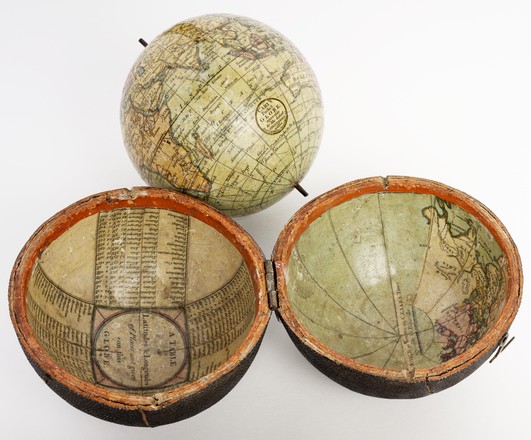
Cary's pocket globe agreeable to the latest discoveries

c. 1791
GLOBE 1
Hand-coloured globe in papier-mâché sharkskin covered case
Purchased from Hordern House in 2009

Pocket globes (pocket-sized globes) measured around 7.5 cm (3 inches) in diameter and were used as status symbols for gentlemen as well as educational tools for children. The popularity of pocket globes peaked in the first half of the 18th century.

Australia’s unknown south coast is marked by a dotted line and Tasmania is joined to the mainland by a peninsula.

The inside of the sharkskin case shows in one hemisphere: ‘The world as known in Caesar’s time agreeable to D’Anville’; and in the other: ‘A table of latitudes and longitudes of places not given on this globe.’


The globe consists of twelve hand-coloured paper gores over a plaster base.


Mapmaker Joseph Moxon (1627–1691) is thought to have produced the first English pocket globe.


The three voyages of James Cook are marked on the face of the globe including ’Owhyee’, the place of his death.


Papier-mâché was considered a cheap construction material.


John and William Cary were London mapmakers who produced and sold maps and globes from the early 1790s to the mid-1800s.