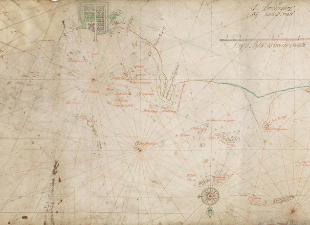
Batavia en Bantam
The map shows town plans of Batavia and Bantam in green and purple; islands and place names in black and red; and coastlines with green wash. Sandbanks are indicated by pecked lines and navigational hazards by crosses. Additional place names for islands and new depth soundings are marked in red and may have been added by the official VOC cartographer in Batavia (Jakarta).