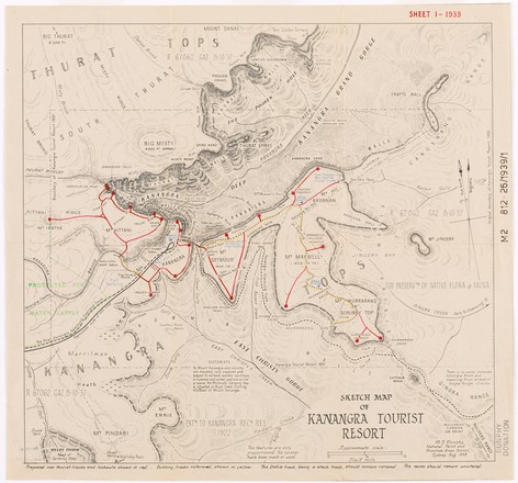
Sketch map of Kanangra tourist resort
1939
M M2 812.26/1939/1
Map
M M2 812.26/1939/1
Map
One of Myles Dunphy’s greatest conservation achievements was the declaration of the Blue Mountains National Park in 1959. The status of ‘National Park’ was significant, as it secured protection of the land.
Dunphy’s favourite spot in the Greater Blue Mountains Area was the Kanangra-Boyd region; one of the most rugged wilderness areas in New South Wales. The magnificent scenery consists of the sheer sandstone cliff faces of the Kanangra Walls, deep canyons, misty mountain tops and several waterfalls. This picturesque landscape is abundant with echidnas and lyrebirds, and is densely covered in eucalyptus trees.
Situated just to the south of Katoomba, the Kanangra-Boyd is a national park that’s a continuation of the Blue Mountains National Park. It comprises of two land units: The Boyd plateau with its labyrinth of creeks, rivers, gorges and ridges, and the Kanangra Walls. In this map, Dunphy has traced new tourist bushwalking tracks along the mountain tops and around the Kanangra Walls to the Kanangra Falls, which flow into Deep Kanangra Canyon.