Sketch shewing the different lines of road descending from the Blue Mountains towards Bathurst
1855
A 331 (opp. p 20)
Pencil and ink drawing
A 331 (opp. p 20)
Pencil and ink drawing
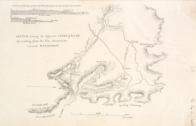
When the controversial Scot Sir Thomas Livingstone Mitchell arrived in New South Wales in 1827 to take up the post of assistant surveyor-general, the Survey Department was in shambles. Mitchell quickly introduced new techniques and technologies to the ill equipped and under resourced department at the crucial time when the expansive inland areas of the colony were being opened up by settlers.
Mitchell created this plate for Progress in Public Works & Roads in NSW 1827-1855, a report that was probably used as part of the evidence prepared for an inquiry into the accuracy and efficiency of the Surveyor-General's Department. This document is based upon the sketches Mitchell made between 1827 and 1830 when he discovered and marked out a new descent from Mount Victoria to Bathurst on the western side of the Blue Mountains.
This map compares two passages across the mountains: the ‘Present Road’ (which was then in use) created by engineer William Cox in 1815, and ‘Major Mitchell’s marked line’. Cox’s route avoided the worst of the ridges, but forced people to travel in a wide, steep arc around Mount York which headed north then descend south-west into the Hartley Valley.