Map of Brisbane Town, Moreton Bay
1839
Manuscript map
Bequest of Sir William Dixson, 1952
DL Z/Cc 83/2
Manuscript map
Bequest of Sir William Dixson, 1952
DL Z/Cc 83/2
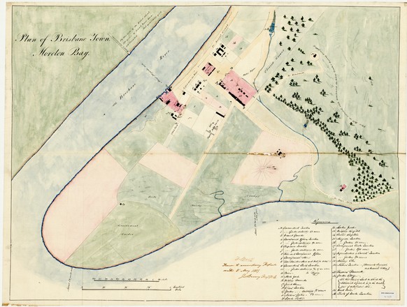
This is the earliest known map of Brisbane. It was drawn by colonial engineer George Barney to accompany a report sent to Governor Gipps in May 1839, less than a year after the settlement had been opened up to free settlers. By the beginning of July, all convicts except those considered essential for assisting with surveying and other government work had been removed.*
The Brisbane area was first settled by the British in 1824, when a penal colony for repeat offenders was established there under the direction of Sir Thomas Brisbane, then governor of NSW. Along with Norfolk Island, it gained a reputation as one of the harshest penal settlements in the colony.
Brisbane was part of NSW until 1859, when Queensland was established as a self-governing British colony, separate from NSW.