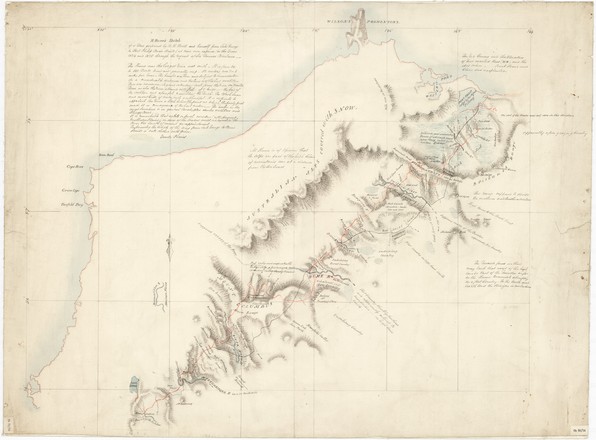
H Hume's sketch of a tour performed by W H Hovell and himself from Lake George to Port Phillip, Bass's Straits
1824-25
Manuscript map
Bequest of Sir William Dixson, 1952
DL SAFE/Cb 82/24
Manuscript map
Bequest of Sir William Dixson, 1952
DL SAFE/Cb 82/24
This map is thought to have been drawn by Thomas Mitchell, who would have recently arrived in the colony to work as the assistant surveyor-general. The map appears to be based on an original made by Hume during the journey on a skeleton map provided by the governor, or was copied from such a copy. It is the work of a professional draftsman, working rather quickly.
The map shows the route taken by Hume and Hovell from Hume’s property near Gunning in NSW to and from Port Phillip. As noted on the map, the journey was made ‘at their own expense in the years 1824 and 1825 through the request of Sir Thomas Brisbane’. Unusually, the map is oriented with south at the top.