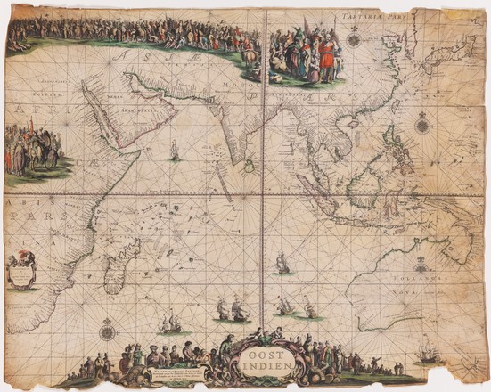
Oost Indien wassende-graade paskaart
167?
Printed map on vellum
Amsterdam: Pieter Goos, [167-?]
Bequest of Sir William Dixson, 1952
Z/Cc 67/1
Printed map on vellum
Amsterdam: Pieter Goos, [167-?]
Bequest of Sir William Dixson, 1952
Z/Cc 67/1
This rare sea chart extends from the Cape of Good Hope to the far east of Australia. It is based on an earlier map by Goos from 1658, thought to be the first to name all the Dutch discoveries in Australia, including those made by Abel Tasman during his voyages of 1642–43 and 1644.
This chart was designed as a showpiece, but less elaborate versions would have been used by the navigators of the powerful Dutch East India Company ships sailing between the East Indies and Europe. The fastest route to the East Indies was to travel south to the Cape and then sail east 3000 nautical miles with the Rroaring Fforties before turning north towards Sunda Strait and Java to Batavia (Jakarta). Without the ability to judge longitude with accuracy, a number of ships were wrecked on the west coast of Australia.


 Back to list