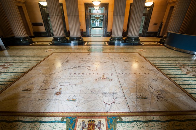
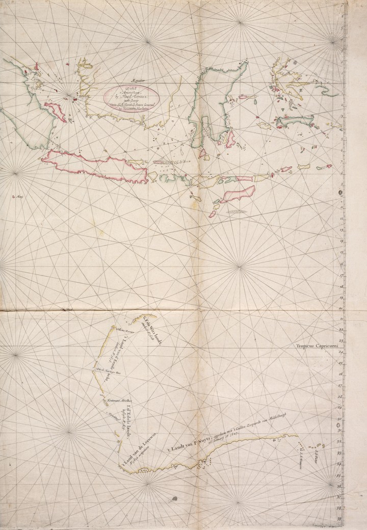
This mosaic shows the voyages made by the Dutch explorer Abel Janszoon Tasman in 1642–43 and 1644. It replicates the famous ‘Bonaparte-Tasman Map’, the first European map to largely depict western and southern Australia’s coastline and neighbouring Pacific islands. The original map, now one of the Library’s most prized possessions, was most likely based on a chart prepared by Tasman’s chief pilot and advisor, Franchoijs Visscher, probably some 40 years after the expeditions.
On his 1642–43 journey, Tasman sailed from Batavia (now Jakarta) in Indonesia along Australia’s south coast, around the southern tip of Tasmania, and on to New Zealand, Tonga and Fiji before returning to Batavia via the north coast of New Guinea. On his 1644 voyage he charted much of Australia’s north-west coast and the south-west coast of New Guinea. The routes are marked on the mosaic by dotted lines and the words ‘Abel Tasman’s passagie.’ Above the map are cherubs holding early navigation instruments, including celestial spheres, cross staff and compass. The cherubs at each corner represent the four winds.
Made of marble with inlays of brass and coloured marble granules, the mosaic took many hours of painstaking and accurate work to complete. It was created by Sydney’s leading marble and mosaic workers, the Melocco Brothers of Annandale, who also created all other marble work in the building.
From the high seas
Today 13 do: Observed latitude 42 degr: 10 min: Longitude 1188 degr:28 mi …
In the evening we deemed it advisable
and ordered our makes
to maintain the Southeast Course
as long as it remains quiet
but to run due East if the Breeze should freshen
in order not to fall ashore
and to prevent any accidents as far as we can
for we sustain that this Land cannot be made from this side
and that on account of the High open sea
which is running into it with huge hollow waves and a heavy swell: unless there should happen to be some land-locked bays on side
in the first watch four glasses having run out we shaped our Course Due East variation 7 degr:30 minutes/ northeasterly …
Footnotes
From the journal of Abel Tasman, 1642-43
State Library collection, Safe 1/72
Rich discoveries
The Dutch explorer Abel Janszoon Tasman is credited with the European discovery of Tasmania, New Zealand and Fiji. He was sent on the expedition by the governor-general of the Dutch East Indies, Anthony van Diemen, to discover what many believed was ‘the great southern land’ which was thought to possess an abundance of riches and resources. During his voyages, Tasman mapped large areas of Australia and other Pacific islands, paving the way for British settlement over a century later.
Another remarkable journey
Hand-drawn on delicate Japanese paper, the original ‘Bonaparte-Tasman Map’ was created about 1695. By 1860 it was in the possession of Jacob Swart, who was head of the Van Keulen company, the official mapmakers of the Dutch East India Company. Along with much of the company’s stock, the map was passed to Frederick Muller, and from him, it was purchased by Prince Roland Bonaparte. A grandson of Emperor Napoleon I’s brother Lucien, the prince was a passionate traveller and president of the Geographical Society of France, the world’s oldest geographical society. He stated that he believed the map should be housed in Australia, and while this was never made explicit to anyone in Australia, it was recorded in an Australian writer’s book of reminiscences. This book was read on the edge of the Nullarbor Plains by anthropologist Daisy Bates, who was working there among the Aboriginal people. She then wrote to the principal librarian William Ifould about it. Ifould in turn contacted Prince Bonaparte’s heir, Princess George of Greece, who in 1931 donated the map to the Library.