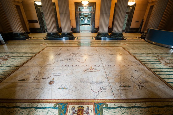
Tasman Map
c.a 1939-41
This mosaic shows the voyages made by the Dutch explorer Abel Janszoon Tasman in 1642–43 and 1644. It replicates the famous ‘Bonaparte-Tasman Map’, the first European map to largely depict western and southern Australia’s coastline and neighbouring Pacific islands. The original map, now one of the Library’s most prized possessions, was most likely based on a chart prepared by Tasman’s chief pilot and advisor, Franchoijs Visscher, probably some 40 years after the expeditions.
On his 1642–43 journey, Tasman sailed from Batavia (now Jakarta) in Indonesia along Australia’s south coast, around the southern tip of Tasmania, and on to New Zealand, Tonga and Fiji before returning to Batavia via the north coast of New Guinea. On his 1644 voyage he charted much of Australia’s north-west coast and the south-west coast of New Guinea. The routes are marked on the mosaic by dotted lines and the words ‘Abel Tasman’s passagie.’ Above the map are cherubs holding early navigation instruments, including celestial spheres, cross staff and compass. The cherubs at each corner represent the four winds.
Made of marble with inlays of brass and coloured marble granules, the mosaic took many hours of painstaking and accurate work to complete. It was created by Sydney’s leading marble and mosaic workers, the Melocco Brothers of Annandale, who also created all other marble work in the building.