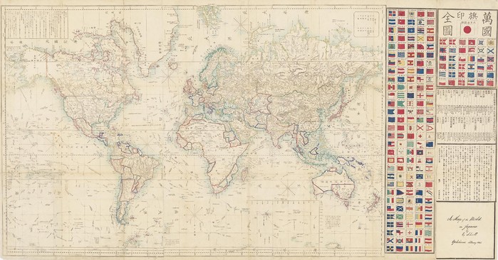
A map of the world in Japanese published by Edward Schnell, 1862
Yokohama, Japan
Hand-coloured copper engraving
M4 100/1862/1
Purchased 2015
This map was produced for a Japanese audience but uses traditional Western cartographic conventions and historical content including the routes of significant explorers such as Cook, Vancouver, La Perouse and Flinders.
This is one of the first Japanese maps to be based on the Mercator projection. The first Mercator based map, a new world map on Dutch sources, also held by the Library, was produced only a few years earlier by Seiyo Sato in 1857.