Spain, Portugal and Morocco: Coasts of Andalucía, Algarve and Northern Morocco, c. 1759
Spain, Portugal
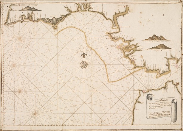
and Morocco: Coasts of Andalucía, Algarve and Northern Morocco, c. 1759 Thomas
López y Chaves after Francisco Ortiz
Hand
drawn and coloured on laid paper
SAFE/MT4
910/1770/1 & 2
Acquired
from Barry Lawrence Ruderman Antique Maps in 2014
This manuscript chart shows the coastline of Andalucia from the British fortress of Gibraltar westwards, and extending to the Portuguese Algarve coastline as far as Cape St. Vincent. The chart features the powerful city of Cadiz, central to naval and trading operations to the Americas and the Pacific in the eighteenth century.