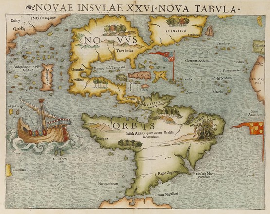
Novae insvlae XXVI nova tabvla
Novae insvlae XXVI nova tabvla
Sebastian Münster
Hand
coloured wood engraving
M2
122/1552/1
This map first appeared in 1540 in Sebastian Munster’s publication of Ptolemy’s Geographia and in later editions until 1552. It was also issued in many editions of Munster’s Cosmographia from 1544 to 1628.
Munster’s map is the earliest to show the whole continent of America and the first to use Magellan’s name, Mare Pacificum (Pacific Ocean). Magellan’s galleon, Victoria, is shown near the straits of Magellan.