Settlement
The Parish of Gordon in the County of Cumberland was named by Thomas Mitchell during his time as Surveyor-General (1828-1855). Much of this area is now known as the Ku-ring-gai municipality. This Upper North Shore municipality was named after the Kuringgai (or Guringai) people who originally inhabited the area. It was once heavily forested, but was cleared in the early to mid 19th century by timber-getters and early settlers with the help of convict labour. This paved the way for farmers and orchardists.
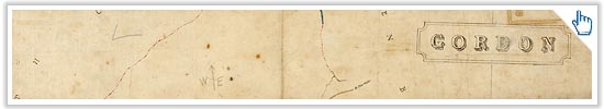
> View a map of the Parish of Gordon from the 1850s
As land was cleared and roads and railway made travelling into Sydney faster and easier, packages of land were sold off for residential development. The area developed much of its suburban character in the early part of the 20th century. Subdivision plans in the Library's collection give a fascinating insight into how North Shore property was marketed.
> View early 20th century subdivision plans of the suburbs between Wahroonga and Roseville

The coming of the North Shore railway changed the area dramatically, opening it up for residential development. Sir Henry Parkes' daughter, Annie Thomasine, turned the first sod for the St Leonards to Pearce's Corner (Hornsby) railway line on August 10th, 1887. The line was opened on January 1st, 1890 and was further extended from St Leonards to Milsons Point in 1893. Annie's ceremonial spade, held in the Library's collections, commemorates the start of the North Shore railway line.
Get the latest Flash player to view this interactive content.

> View full catalogue record and images for the ceremonial spade ![]()