Durham County maps
County Durham, bounded to the west and south by the Hunter River, takes in the rich agricultural land of the Paterson and Allyn River valleys in New South Wales. In the 19th century, the area was well suited for homesteads, dairying, raising livestock and the cultivation of crops including wheat, maize, barley, oats, fruit orchards and vineyards.
This 1843 map of Durham County shows the various land grants and purchases in the area at the time. It was compiled for Baker's Australian county atlas: dedicated by the publisher to Sir T.L. Mitchell ... showing the various parishes, townships, grants, purchases and unlocated lands, 1843.
The map shows the land originally settled by Welshmen George Townshend (1798-1872) and Charles Boydell (1808-1869), who took up land grants Trevallyn and Camyr Allyn, near Gresford in County Durham. Alexander Park (1808-1873) owned a large neighbouring grant on the left bank of the Allyn River. In 1840, Charles Boydell transferred land at Allynbrook to his younger brother, William Barker Boydell (1818-1878), which he named Caergwrle. By 1843, much of the land was settled, taken up by homesteads and farms and grazing land.
Map of the County of Durham, dedicated by permission to Sir T.L. Mitchell, Surveyor General of New South Wales, compiled expressly for the printer and publisher of the Australian Atlas, William Baker, East Sydney, 1843. Printed. Z/M2811.24/1843/1
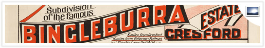
> See a selection of later subdivision plans of the area, 1900-1950